Logo data.gv.at
57499
776
1376
Datasets
Applications
Organizations
  • de
  • en
Bluesky Logo Mastodon Logo Facebook logo Linkedin Logo Instagram logo RSS logo
Jetzt mitreden: EU startet öffentliche Konsultation zur Strategie für eine europäische Datenunion
Hauptmenü
    • Find dataset
    • Total inventory of datasets

    • High-value datasets according to IWG 2022
    • Tendering according to BVergG2018
    • API Hub
    • COVID-19 Information Portal
    • Geospatial data – INSPIRE

    • Datasets with application count
    • Publishing bodies
    • Interactive Data Visualization

    • Data publication guide
    • Add Data/Documents
    • Find application
    • Submit application

    • Open Source Applications
    • Objective data.gv.at
    • Open Data principles
    • Development of Open Data
    • E-learning modules on Open Data
    • Open Data Videos

    • Cooperation OGD Austria
    • Cooperation OGD D-A-CH-LI

    • Open Data Flyer
    • Open Data Guide
    • Open Data Practice Guide (AGEO)
    • Guide Open Data Analysis
    • Guide Open Data Governance

    • Information on BVergG 2018
    • Netiquette
    • Accessibility declaration
    • Privacy policy
    • Social media platforms
    • Imprint
    • News
    • Subscribe to newsletter
Application

WMTS Höhenmodell Österreich 10m

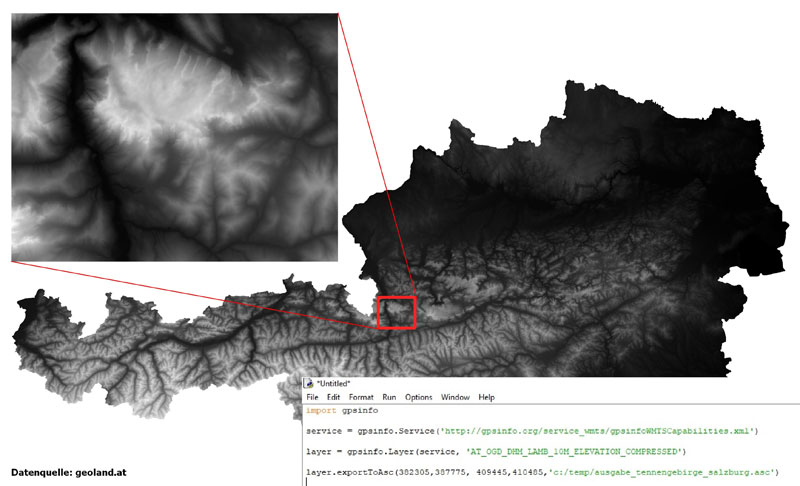
Das Höhenmodell Österreichs von geoland.at mit 10 m räumlicher Auflösung ist nun auch als WMTS–Service frei über das Internet verfügbar.

Für den einfachen und raschen Download für Ihr Projektgebiet („bounding box“) gibt es für ArcGIS 10.x und Q-GIS 3.x fertige Pythonbibliotheken.

Der Gesamtdownload des gesamten Höhenmodells Österreichs ist nun nicht mehr notwendig.

Weitere Informationen und Vorteile für die Nutzung des WMTS-Standard für die Bereitstellung und Abfrage von punktbasierten thematischen Informationen (z.B: Höhendaten, ...) finden Sie unter dieser URL:

Category
  • Regions and cities
Type
  • Data processing tool
  • Concept
API Link to Metadata
/api/3/action/package_show?id=72cf1e12-9102-45f9-9de9-9f2e1c64957b
Metadata Modified
June 11, 2024, 08:14 (+0200)
Translate to
Contacts Manfred Egger
https://www.egger-gis.at/
manfred@egger-gis.at
Applications Referenzseite aufrufen
gpsinfoWMTSCapabilities.xml
Netidee.at-Projektbeschreibung
Source URL {https://github.com/gpsinfo/gpsinfo_lib.py,https://github.com/gpsinfo/gpsinfo_for_arcgis_python27}
Publishers of datasets used
  1. Geoland.at
  • Digitales Geländemodell (DGM) Österreich
  • comments powered by Disqus
    Find datasets
    Applications
    Info
    News
    List applications
    Submit applications
    Imprint
    Data privacy
    Accessibility
    Writing data.gv.at
    Bluesky Logo Mastodon Logo Facebook logo Linkedin Logo Instagram logo RSS logo
    Cooperation OGD Austria
    Further data: Logo Inspire Österreich data.europa.eu ODP Logo